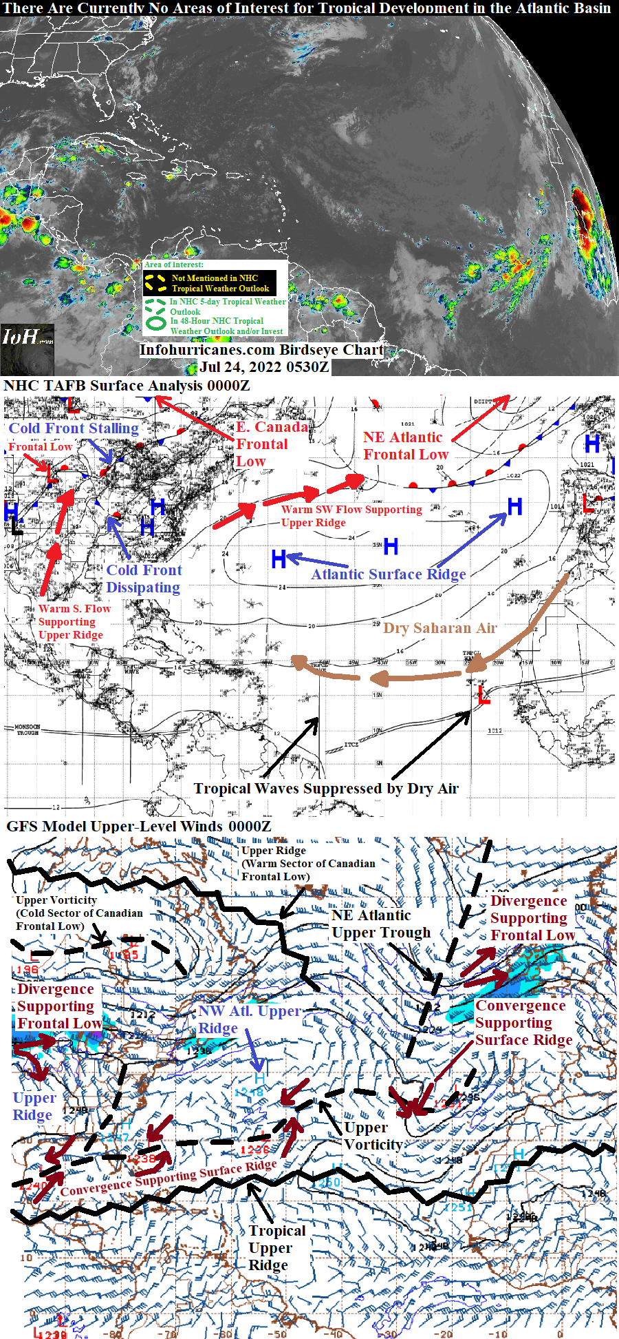
MY 2022 ATLANTIC HURRICANE SEASON BIRDSEYE VIEW POST #54
- NCHurricane2009

- Jul 24, 2022
- 2 min read
*******Note that forecasts and outlooks in this post are NOT the official forecast from the National Hurricane Center (NHC). They are my own detailed views on the Atlantic tropics based on current observations and latest computer model runs. As such do not make decisions based on my posts...consult news media...watches and warnings from your local weather office...and any evacuation orders issued by local governments to make the most informed and best decisions. Visit the NHC website hurricanes.gov (hurricanes dot gov) for the latest watches/warnings and official forecasts on active tropical cyclones.**********
...SUNDAY JULY 24 2022 3:15 AM EDT...

Conditions across the tropical Atlantic have remained unfavorable for tropical cyclone formation for the following couple of reasons:
(1) An outbreak of dry saharan air across the eastern and central tropical Atlantic.
(2) The current configuration of the Madden Julian Oscillation (MJO) for much of July has favored suppressed thunderstorm activity in the Atlantic tropics(https://www.cpc.ncep.noaa.gov/products/precip/CWlink/MJO/mjo.shtml). However the latest data shows the upward-motion (thunderstorm enhancing) portion of the MJO shifting east toward the Atlantic basin. Therefore by August conditions in the tropical Atlantic may be more conducive for tropical cyclone development.
In addition...monitoring the progress of an African tropical wave of low pressure which has recently advanced into Mali and surrounding west African nations to the west of Mali. The adjacent tropical wave to the west... currently in the eastern Atlantic... has succumbed to the dry saharan air layer and thus will not aid the west African wave in repelling the dry air. Per the ongoing computer model solutions... the west African wave will also likely track north enough to ingest the dry air while also being exposed to cooler east-central Atlantic water temperatures over the next few days. Therefore per the latest computer model consensus... the west African tropical wave at most will become a large tropical low pressure spin that struggles with unfavorable thermodynamic conditions (dry air and cooler water)... and as a result I have not upgraded this tropical wave to an area of interest for tropical development at this time.
...COMPUTER MODEL SUMMARY...
Source...Florida State University Experimental Forecast Tropical Cyclone Genesis Potential Fields (http://moe.met.fsu.edu/tcgengifs/)
1200Z (Jul 23) CMC Model Run...
**No tropical cyclone formation forecast for the Atlantic basin for the next 168 hours (7 days)
1200Z (Jul 23) ECMWF Model Run...
**Current tropical wave over Mali emerges into the eastern tropical Atlantic by 72 hours as a large tropical low... center of the large tropical low located near 15N-39W at 120 hours.
1800Z (Jul 23) GFS Model Run...
**Current tropical wave over Mali emerges into the eastern tropical Atlantic from the Western Sahara/Mauritania border at 66 hours... while evolving into a tropical low passes just north of the Republic of Cabo Verde Islands at 84 hours... tropical low weakens back to a tropical wave near 19N-31W at 105 hours...
1800Z (Jul 23) NAVGEM Model Run...
**Current tropical wave over Mali emerges into the eastern tropical Atlantic at 66 hours... evolves into a tropical low that passes over the Republic of Cabo Verde Islands at 90 hours... tropical low located near 15.5N-35W at 120 hours.


Comments